Land surveying has undergone a remarkable transformation in recent years, shifting from traditional ground-based methods to cutting-edge aerial solutions. The global commercial drone market is expected to grow at a 23.8% CAGR, showing how industries are increasingly confident in unmanned aerial technology.
This rapid expansion reflects how professionals are embracing drone surveying technology to address longstanding challenges in accuracy, efficiency, and cost-effectiveness.
What once required weeks of manual fieldwork can now be accomplished in a matter of days, fundamentally changing how we approach terrain mapping and property assessments.
Transforming Traditional Surveying Methods
Modern surveying practises are evolving at breakneck speed, with aerial solutions becoming the new standard for precision mapping. Traditional methods, while reliable, often struggle with accessibility and time constraints that today’s projects simply can’t afford.
Enhanced Precision Through Advanced Technology
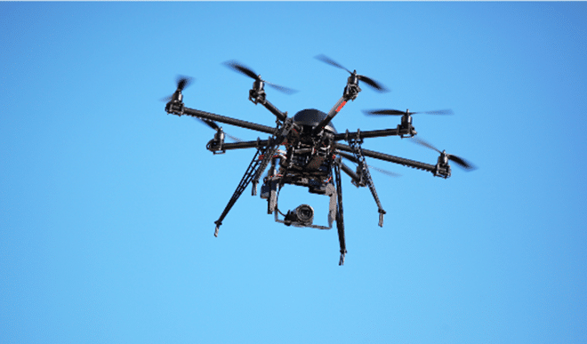
A comprehensive UAV Drone Survey delivers accuracy levels that were previously unimaginable with conventional techniques. These sophisticated systems capture high-resolution imagery and LiDAR data, creating detailed topographical maps with centimetre-level precision.
Multi-Sensor Integration for Superior Accuracy
Companies like FEDS Drone-Powered Solutions are pioneering applications that combine multiple sensor technologies to provide comprehensive site analysis.
The integration of GPS positioning and real-time kinematic (RTK) systems ensures that every data point is georeferenced with exceptional accuracy. This precision eliminates guesswork and reduces the margin for error that is usually associated with manual surveying methods.
Speed and Efficiency Gains
With a few movements, land surveying drones can cover expanses that would take ground teams months to cover evenly. Aerial surveys can collect as much data in a few days as it takes traditional surveys to capture in several weeks. This productivity saves costs and time.
The automated flight patterns and data acquisition techniques mean that surveyors will have more time to analyse data rather than spend hours taking measurements out in the field.
Industry-Specific Applications
The use of aerial land measurement techniques has gone so far beyond simply mapping properties that the entire method of collecting spatial data in different sectors has completely shifted.
Construction and Development Applications
Construction projects benefit enormously from the comprehensive site analysis that drones provide. Pre-construction surveys help identify potential obstacles, while ongoing monitoring tracks progress and ensures adherence to original plans.
The advantages of UAVs as problem-solving survey tools are especially obvious when working within hazardous or inaccessible areas. Project managers are now in a position to make informed decisions using current aerial imagery, eliminating the risk of delays or design changes during the construction stage, which have cost implications.
Environmental and Agricultural Surveillance
Drone technology is relevant in the field of environmental consulting, as the technology is being developed to survey sensitive ecosystems without disrupting animal habitats. In farming, applications include crop health evaluation, irrigation design, and production forecasts.
Because it is non-invasive, aerial surveying is very useful in studying sensitive or guarded areas or tracking environmental trends.
UAV Technology Comparison
| Feature | Traditional Surveys | UAV Surveys |
| Coverage Speed | 5-10 acres/day | 100+ acres/day |
| Data Accuracy | ±2-5cm | ±1-3cm |
| Weather Dependency | Low | Moderate |
| Safety Risk | High (terrain hazards) | Low (remote operation) |
Surveying Innovation for the Future
The learning boom in unmanned aerial systems technology has fundamentally transformed what can be done in land survey. With the technology still improving, there is a likelihood that more advanced applications will be developed now and in the future, such as automated analysis of AI and real-time processing of data.
This technology change is something that has been adopted in the industry, and individuals who embrace it early enough will be in an excellent position to handle any future challenges.
FAQs About Drone Surveying
1. What is the main strength of drones in surveying?
Among the main advantages of using drones to conduct surveys is speed and efficiency. Using drones means being able to cover large areas within a relatively short period and with sufficient detail compared to the traditional surveying method.
2. How can we use drones to facilitate surveys?
Surveying drones are fitted with onboard cameras that take photographs of the ground at various points from the air. The GNSS sensor on the drone provides the geo-coordinates on which to tag the images, where the images are found in space.
3. Are drone surveys legal in the UK?
Yes. The use of drones to conduct surveys is completely legal in the UK as long as the operators are licensed by the CAA, abide by the laid-down rules, are adequately certified and insured to conduct business.